该类用于定义一个图片图层 更多...
#include <BMKGroundOverlay.h>
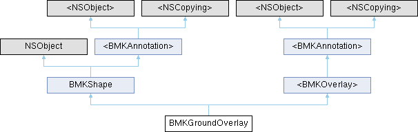
类 BMKGroundOverlay 继承关系图:
类方法 | |
| (nullable instancetype) | + groundOverlayWithPosition:zoomLevel:anchor:icon: |
| (nullable instancetype) | + groundOverlayWithBounds:icon: |
Public 属性 | |
| float | zoomLevel |
| CLLocationCoordinate2D | _pt |
| BMKCoordinateBounds | _bound |
| CGPoint | _anchor |
| UIImage * | _icon |
| BOOL | isCenterPt |
属性 | |
| CLLocationCoordinate2D | pt |
| CGPoint | anchor |
| CGFloat | zoomLevel |
| 不损失精度绘制原始图片的地图等级,无默认值 | |
| BMKCoordinateBounds | bound |
| 两种绘制GroundOverlay的方式之二:绘制的地理区域范围,图片在此区域内合理缩放 | |
| UIImage * | icon |
| 绘制图片 | |
| GLfloat | alpha |
| 图片纹理透明度,最终透明度 = 纹理透明度 * alpha,取值范围为[0.0f, 1.0f],默认为1.0f | |
 属性 继承自 BMKShape 属性 继承自 BMKShape | |
| NSString * | title |
| 要显示的标题;注意:如果不设置title,无法点击annotation,也无法使用回调函数; | |
| NSString * | subtitle |
| 要显示的副标题 | |
| 属性 继承自 <BMKAnnotation> | |
| CLLocationCoordinate2D | coordinate |
| 标注view中心坐标. | |
| 属性 继承自 <BMKOverlay> | |
| CLLocationCoordinate2D | coordinate |
| 返回区域中心坐标. | |
| BMKMapRect | boundingMapRect |
| 返回区域外接矩形 | |
额外继承的成员函数 | |
| 构造函数 继承自 <BMKAnnotation> | |
| (NSString *) | - title |
| 获取annotation标题 | |
| (NSString *) | - subtitle |
| 获取annotation副标题 | |
| (void) | - setCoordinate: |
| 构造函数 继承自 <BMKOverlay> | |
| (BOOL) | - intersectsMapRect: |
详细描述
该类用于定义一个图片图层
函数文档
◆ groundOverlayWithBounds:icon:
| + (nullable instancetype) groundOverlayWithBounds: | (BMKCoordinateBounds) | bounds | |
| icon: | (UIImage *) | icon |
根据指定区域生成一个groundOverlay
- 参数
-
bounds 指定的经纬度区域 icon 绘制使用的图片
- 返回
- 新生成的groundOverlay对象
◆ groundOverlayWithPosition:zoomLevel:anchor:icon:
| + (nullable instancetype) groundOverlayWithPosition: | (CLLocationCoordinate2D) | position | |
| zoomLevel: | (CGFloat) | zoomLevel | |
| anchor: | (CGPoint) | anchor | |
| icon: | (UIImage *) | icon |
根据指定经纬度坐标生成一个groundOverlay
- 参数
-
position 指定的经纬度坐标 zoomLevel 不损失精度绘制原始图片的地图等级 anchor 绘制图片的锚点 icon 绘制使用的图片
- 返回
- 新生成的groundOverlay对象
类成员变量说明
◆ _anchor
| - (CGPoint) _anchor |
◆ _bound
| - (BMKCoordinateBounds) _bound |
◆ _icon
| - (UIImage*) _icon |
◆ _pt
| - (CLLocationCoordinate2D) _pt |
◆ isCenterPt
| - (BOOL) isCenterPt |
◆ zoomLevel
| - (float) zoomLevel |
属性说明
◆ alpha
|
readwritenonatomicassign |
图片纹理透明度,最终透明度 = 纹理透明度 * alpha,取值范围为[0.0f, 1.0f],默认为1.0f
◆ anchor
|
readwritenonatomicassign |
用位置绘制时图片的锚点,图片左上角为(0.0f,0.0f),向右向下为正 使用groundOverlayWithPosition初始化时生效
◆ bound
|
readwritenonatomicassign |
两种绘制GroundOverlay的方式之二:绘制的地理区域范围,图片在此区域内合理缩放
◆ icon
|
readwritenonatomicstrong |
绘制图片
◆ pt
|
readwritenonatomicassign |
两种绘制GroundOverlay的方式之一:pt、anchor、zoomLevel 绘制的位置地理坐标,与anchor配对使用
◆ zoomLevel
|
readwritenonatomicassign |
不损失精度绘制原始图片的地图等级,无默认值
该类的文档由以下文件生成:
- BaiduMapAPI_Map.framework/Headers/BMKGroundOverlay.h